A single spark in remote wilderness can ignite massive fires that devastate surrounding communities, destroying homes and taking lives. Emergency personnel and the public rely on satellites high above the Earth to detect these fires early and track their spread.
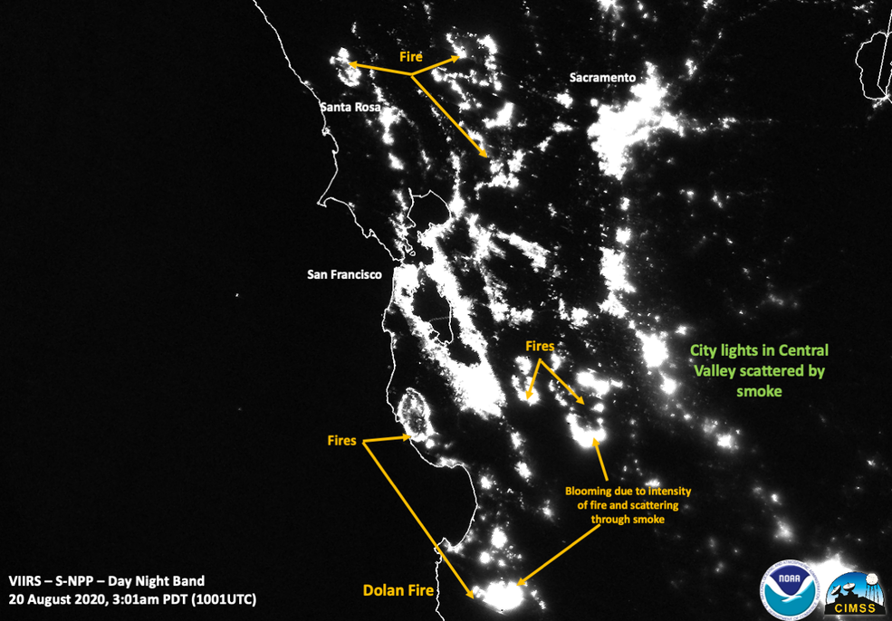
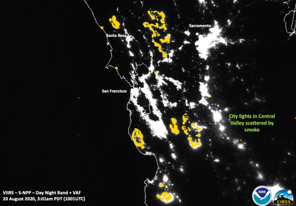
When a lightning storm set Northern California ablaze in August, first responders turned to data from the Visible Infrared Imaging Radiometer Suite (VIIRS), a satellite sensor operated by the National Oceanic and Atmospheric Administration (NOAA) as part of a collaborative program with NASA. VIIRS is a primary sensor on the Suomi National Polar-orbiting Partnership (SNPP) weather satellite, which was launched on October 28, 2011.
VIIRS instruments fly aboard two weather satellites, Suomi National Polar-orbiting Partnership and NOAA-20, as part of the Joint Polar Satellite System (JPSS). Each satellite captures new imagery of the entire Earth every 12 hours, allowing emergency workers to monitor fires day and night. A third VIIRS-carrying JPSS satellite will launch in early 2022.
This life-saving data hinges on spacecraft, sensors, ground systems and algorithms working in perfect harmony. Teams from across The Aerospace Corporation have supported VIIRS since its inception in each domain of the program.
“VIIRS has a unique nighttime imagery capability that enables users to anticipate a fire's evolution based on temperature and smoke plume movement that other sensors aren’t capable of doing,” said David Moyer, a Project Leader at Aerospace.
Before the instrument can be deployed, it must pass a series of performance tests to demonstrate that it can read precise bands of visible and infrared light – even a small deviation in this capability could be the difference between saving or losing a home.
“In order to get data that’s useful to first responders, we need a radiometrically accurate sensor,” said Janna Feeley, an Engineering Manager at Aerospace. “We start in the pre-launch phase doing radiometric testing on the ground, as well as spectral and spatial characterization, to make sure VIIRS is meeting its requirements. In the on-orbit phase, we monitor its calibration stability and accuracy, so we have good radiance values for data exploitation.”
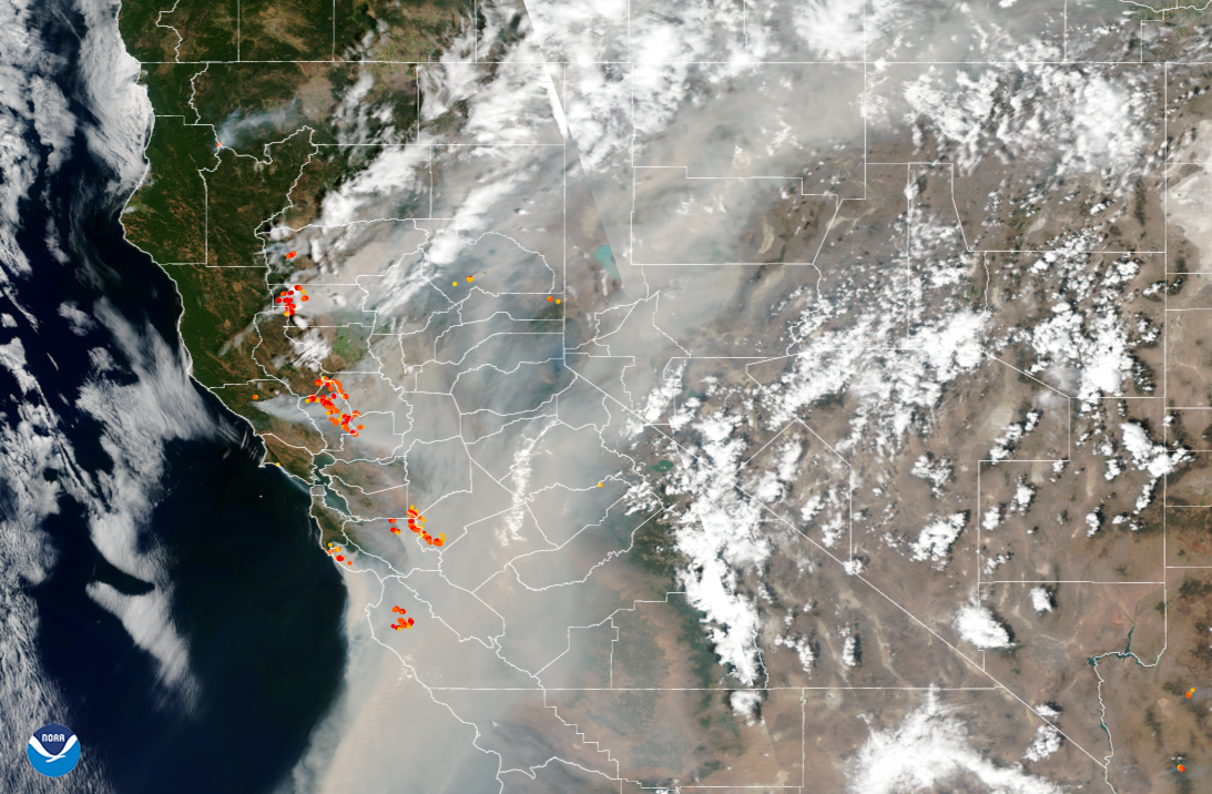
Designed for operational environmental characterization and forecasting , VIIRS was built to measure a unique set of visible and infrared light bands that can isolate certain features of the Earth. Vegetation, clouds, sea ice and fires each reflect or emit specific spectral signatures, which VIIRS can detect.
“Visible and infrared band radiances and brightness temperatures are incorporated into VIIRS algorithms to generate environmental data records that users can exploit to study behaviors of the Earth,” Moyer explained.
Aerospace has leveraged its breadth of space systems experience to serve both NOAA and its acquisition agent NASA throughout the JPSS program, including in the acquisition and launch phases for the sensors, satellites and ground systems.
“We span the full lifecycle,” Feeley said. “We’re carrying forward the knowledge and expertise that we picked up supporting NASA’s prelaunch campaign, and that helps us be more effective in the post-launch phase with NOAA.”
With three more JPSS satellites in the pipeline, Aerospace continues to support the program through independent data analysis and evaluation in parallel with the VIIRS development contractor, Raytheon Intelligence & Space.
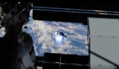
The team is also exploring potential synergies between VIIRS and other innovative technologies, such as Aerospace’s Near Infrared Airglow Camera (NIRAC), which can capture highly refined nighttime imagery from the International Space Station. Feeley said the team is evaluating collocated VIIRS and NIRAC imagery and developing a proof of concept to examine how NIRAC can augment the existing capabilities of VIIRS.
In the current environment, VIIRS provides a critical view from above on fast-moving wildfires and slow-melting sea ice, helping humanity respond to a changing climate.
“The impact of this program is easy to forget when you're in the weeds with ground system-level or sensor issues,” Feeley said. “Aerospace is one of many contributors to VIIRS, but it’s gratifying to see our work enable first responders to save lives.”