

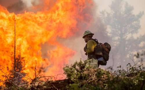
In 2021, more than 2.5 million acres burned due to California’s wildfires—aggravated by drought and intensified temperatures. The estimated economic loss was between $70 billion and $90 billion in the United States, with over half of that attributed to California’s wildfire season alone.
Boosting space surveillance abilities can help improve response time and understanding of how these wildfires develop. The Aerospace Corporation is addressing this growing area of need by identifying opportunities to improve wildfire detection and monitoring capabilities. These proposed efforts could ultimately protect biodiversity, infrastructure and human life, as well as mitigate wildfires’ financially damaging effect.
“Although Aerospace has done previous wildfire monitoring-related work, with the rising number and gravity of California’s wildfires, we sought to conduct a more comprehensive study on this topic to not only understand current wildfire remote sensing but also locate technological areas that could be improved upon,” said Dr. Rob Stevens, Director of Aerospace’s Model-Based Systems Engineering Office. “This effort was made possible by bringing different experts across Aerospace into a room and providing them the digital engineering tools to work concurrently, which ultimately saved time in building a solution.”
Determining What’s Possible
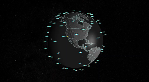
Current satellites that can detect wildfires often have a gap in their capabilities, ranging from a lack of spatial resolution to low revisit frequency times or other essential qualities needed to provide in-depth and up-to-date information. A team at Aerospace is leveraging previous research—including a summer 2022 intern memo on existing architecture options and learned remote sensing principles and techniques—to provide a more comprehensive space vehicle design solution.
“The Overhead Persistent Infrared (OPIR) architectures team, which studies cutting-edge technology and approaches aimed at hard problems, applied their expertise to the wildfire problem,” said Dr. Dee Pack, Principal Scientist in Aerospace’s Space Science Applications Laboratory. “Our experts provided insight on architecture and sensor designs for fire monitoring and detection, information that was taken into account as the project progressed.”
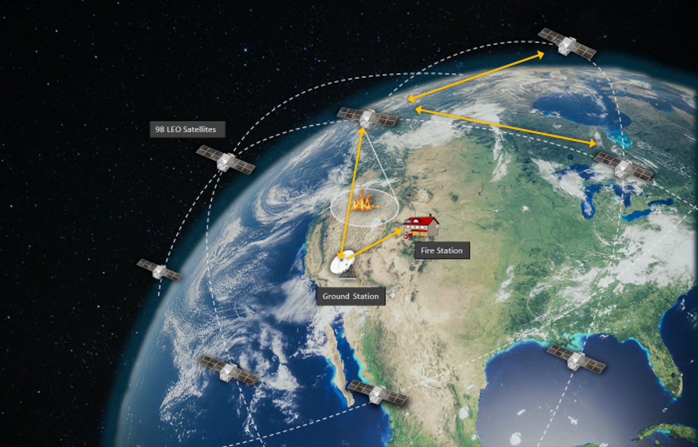
By tuning the bands of some OPIR sensor designs, an impressive wildfire monitoring capability is enabled. The team envisions a constellation of low Earth orbit satellites with compact but powerful sensors. Unlike a singular GEO satellite, which can only survey a limited surface area, a group of small wildfire monitoring satellites can provide more frequent and global coverage of the Earth’s surface.
A Holistic Perspective
Multi-disciplinary teams were able to test their designs in Aerospace’s Concept Design Center (CDC), an environment where sharing data and information in real-time is possible. The CDC’s offering of concurrent and digital engineering tools empowered users to work and execute their designs in a fluid manner.
“Aerospace is unique in that we have experts in every subsystem and we’re able to bring them together,” said Pack. “Short pieces of time for each of those experts go into something that ends up being a full holistic system, where the sum is greater than the individual parts.”
Refining the idea so that it is done in the best possible way at the lowest cost, while also user-friendly for potential customers, requires further investigation and thoughtful revision—a process which can continue to be practiced in the CDC.
“If you’re going to provide an end-to-end solution, you have to invoke a wide variety of expertise at Aerospace,” said Dr. Terrence Lomheim, Distinguished Engineer and Scientist in Aerospace’s Electronic and Sensors Division. “The CDC lab makes it possible for a set of experts across disparate disciplines to effectively interact and determine how to best modify the concept to meet design and cost requirements. Working in this integrated manner enables us to work quickly and build an impactful solution.”


