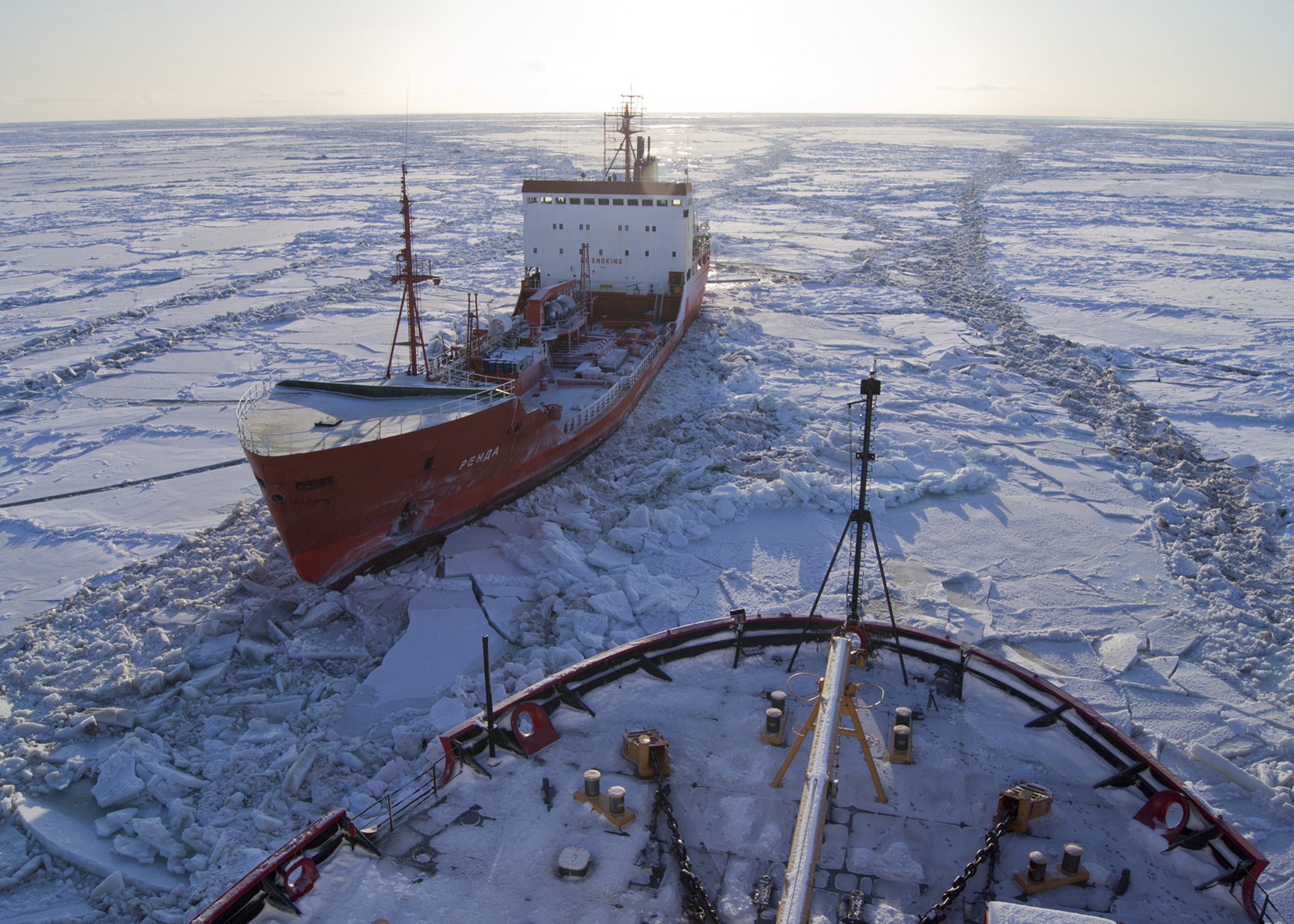
For decades, the dense sea ice covering the Arctic Ocean has been shrinking and, in some regions, disappearing altogether. This environmental change is dramatically altering areas that were once blocked by ice and creating open water that is being turned into shipping lanes for an increasing number of vessels looking for a faster route between Asia, eastern North America and Europe.
According to data from the U.S. Committee On The Marine Transportation System, the number of vessels operating in the Arctic region has increased from 52 in 2008 to 144 in 2013. The committee predicts that the Arctic Ocean will see 2,111 vessels by 2025. This rapid increase in traffic through a dynamic environment like the Arctic has made U.S. Coast Guard (USCG) missions especially challenging while underscoring the need for prompt and reliable emergency distress signal response.
On December 3, Polar Scout launched from Vandenberg AFB, successfully deploying two 6U CubeSats (named Kodiak and Yukon) into a polar orbit. A joint project of the Department of Homeland Security (DHS) Science and Technology Directorate and the Coast Guard Research, Development, Test and Evaluation Program, the Polar Scout mission aims to test the capabilities of small, inexpensive satellites to improve U.S. Coast Guard response to emergency distress signals. The Polar Scout CubeSats will fly over the North Pole roughly every 100 minutes and will be able to detect emergency position indicating radio beacon (EPIRB) signals from stranded vessels for around 12 minutes during each orbit. Because the CubeSats will orbit the earth 15 to 16 times a day, the Polar Scouts will provide more than three hours of Arctic coverage daily.
Polar Scout will demonstrate technologies that could be leveraged to expedite the reporting of search-and-rescue needs in remote and notoriously harsh Arctic regions, where timeliness is of utmost importance. The project will test the viability of using space-based sensors to assist with emergencies in a terrain further complicated by vast distances and lack of infrastructure. The use of satellites in this capacity could potentially reduce the time and resources required for traditional aircraft searches and reduce the need to place search-and-rescue personnel in hazardous situations.
Video: Polar Scout Satellites Aid Arctic Rescue
The Polar Scout project was a rapid solution to a potential problem for the Coast Guard’s search and rescue missions. The next-generation satellite constellation Medium Earth Orbit Search and Rescue (MEOSAR) is not expected to reach full operational capability for another five to 10 years, leaving the Coast Guard with gaps in search-and-rescue coverage. CubeSats may bridge these interim gaps by augmenting existing search-and-rescue coverage until MEOSAR becomes fully operational. To this end, both Kodiak and Yukon are designed to detect 406 MHz emergency distress beacons, which could prove critical to Coast Guard missions.
DHS began test and evaluation of the CubeSats using emergency distress test beacons in the Arctic in early 2019 and will continue through the summer. Those results will be compared with that of the current COSPAS-SARSAT architecture, which currently facilitates 41,000 global rescues annually, with 8,000 of those taking place in the U.S.
In the spring, the Polar Scout Project will initiate two demonstrations. Both demonstrations will include deployment of test Emergency Position-Indicating Radio Beacons (EPIRBs) in various U.S. Coast Guard search-and-rescue regions, including the Arctic region. Both demonstrations will require Yukon and Kodiak to detect fixed reference beacons as well as beacons deployed from moving platforms.
The Aerospace Corporation has supported DHS and the Polar Scout project by providing systems engineering, mission analysis, and assurance support to the government and is continuing to provide support to monitoring and resolving system anomalies.
“Aerospace is bringing value to this project by translating our tried-and-true mission assurance methods to CubeSat-class vehicles,” says Polar Scout Project’s Chief Engineer Margherita P. Eastman. “Using a small team of engineers, we focused on the high-risk areas—space and ground—and provided recommendations to quickly resolve the issues at minimal cost.”
Ultimately, Polar Scout will yield a “road map” of CubeSat technology that will provide guidelines for applying space innovation to better support Coast Guard missions. While CubeSats are not intended to replace COSPRAS-SARSAT, they may prove capable of providing an interim solution. Likewise, a similar approach could ultimately be applied to provide space-based capabilities and technologies to assist in other DHS missions, such as border surveillance, and to aid in the investigation of illegal fishing and wildlife poaching.