
There's a new satellite in orbit, just launched by India's ISRO space agency. The NASA-ISRO Synthetic Aperture Radar (NISAR) mission will soon begin the task of scanning the Earth's surface with unprecedented precision, and Aerospace helped prepare it for orbit.
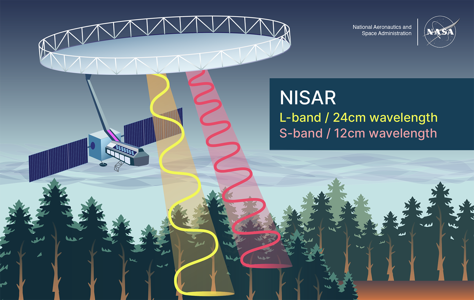
Synthetic aperture radar can capture 3D imagery of the surface at night and through cloud cover, and NISAR is the first mission to use both L- and S-band wavelengths to scan the entire planet every 12 days. These frequent, high-resolution scans will allow researchers to track fast-moving changes like forest growth and fires, landslide risks, rising sea levels, and other factors for years to come.
The satellite was primarily designed by ISRO and NASA's Jet Propulsion Laboratory, and Aerospace supported the mission across a number of domains, like thermal engineering, flight operations, and system verification.
“Spacecraft thermal environments can be incredibly hostile, with wide swings between extreme heat and cold,” said Aerospace's Alexander Pagano, thermal engineering support lead for the mission. “My role was to make sure that NISAR’s instruments would function optimally, regardless of the conditions it encounters in orbit.”
NISAR will provide a tremendous amount of data — hundreds of terabytes — and all of it will be available to the public. More details on the mission and Aerospace's role in it can be found here, or at the links below.