

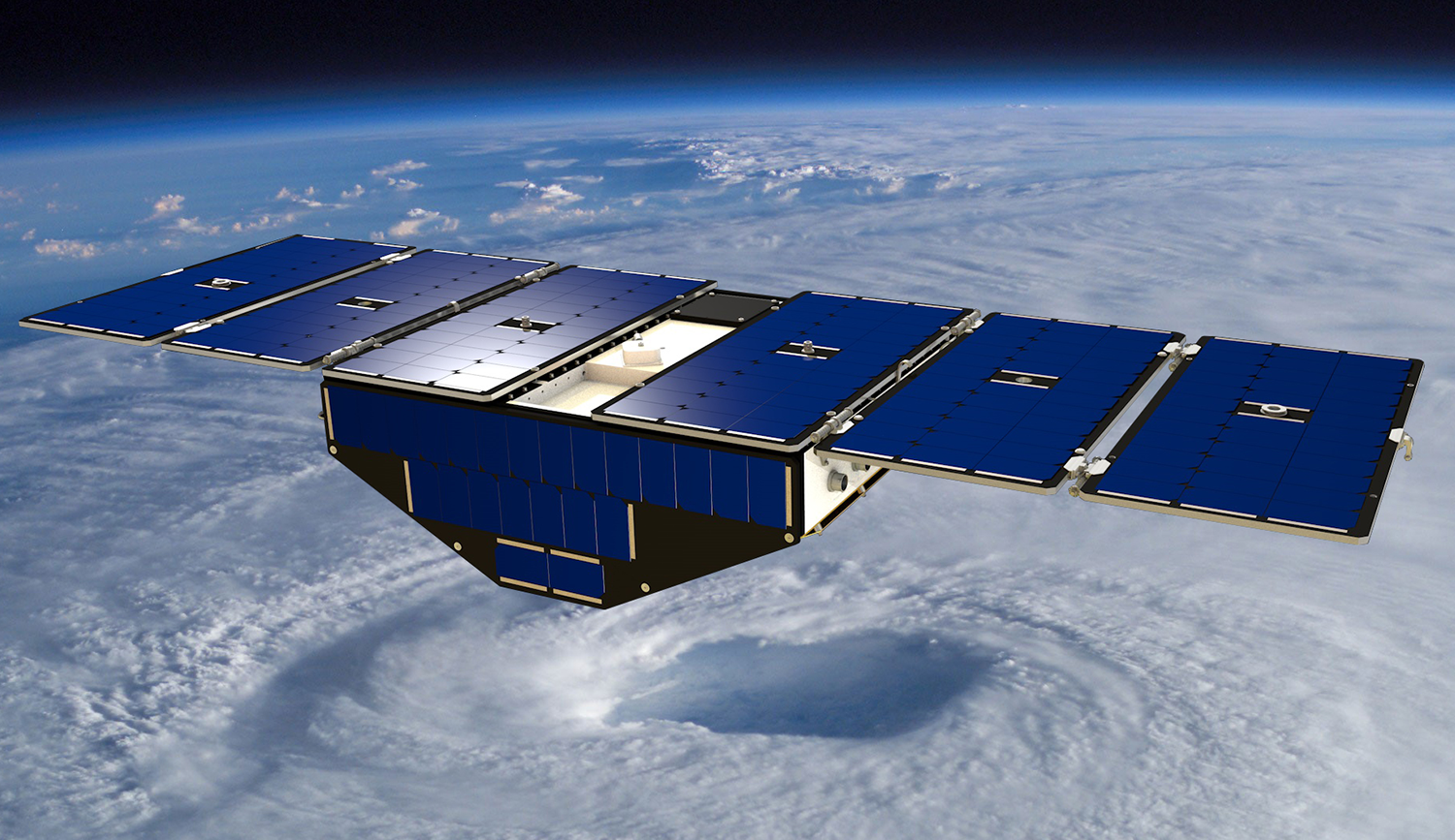
The Aerospace Corporation played a significant role in the development of GPS, and is now playing a key role in testing a critical subsystem of the Cyclone Global Navigation Satellite System (CYGNSS), an eight-microsatellite constellation that was launched in December and is expected to be fully operational before this year’s hurricane season begins.
CYGNSS’ eight microsatellites were developed by the Southwest Research Institute (SwRI) under contract to the University of Michigan, with Aerospace providing support to SwRI by way of developing a Spacecraft Dynamics Simulator (SDS) for use in end-to-end testing of the microsatellite attitude determination and control subsystem.
Novel Methodologies Reduce Mission Cost
CYGNSS is using a novel mission architecture to calculate wind speeds that both reduces the mission’s cost while increasing the amount of data accumulated.
The measurement of ocean wind speed from space has typically employed a technique known as “scatterometry,” in which a radar instrument aboard a satellite transmits a signal to the ocean surface, and subsequently receives the reflected signal. Unlike other satellites, however, CYGNSS microsatellites don’t transmit; they only receive, enabling the reception of ocean-reflected signals broadcast from existing GPS satellites.
As a result of this design simplification, CYGNSS microsatellites are less complex compared to traditional satellites, resulting in significant mission cost savings. They’re also significantly smaller, as a CYGNSS microsatellite is roughly the size of a small suitcase when its solar arrays are stowed.
In building the SDS units, Aerospace’s Civil Systems Group (CSG) and Engineering and Technology Group (ETG) staff applied their extensive expertise in developing and delivering similar hardware-in-the-loop and software-in-the-loop simulators as part of the mission assurance process. A total of 11 SDS units were integrated and tested at Aerospace before delivery to SwRI.
Microsatellite Constellations
Microsatellite constellations provide higher quality data than single satellites, as a constellation can pass over a given location on the Earth’s surface more frequently than a single satellite, resulting in a more detailed view of changes in ocean winds over time.
The added quality and quantity of surface wind data, combined with precipitation fields produced by NASA’s Global Precipitation Measurement mission, can provide data that will allow hurricane forecasters to improve weather forecast models used to predict both the track and intensity of land-falling hurricanes. This data also will enable more accurate weather forecasts of wind speeds and storm surges—the walls of water that do the most damage when hurricanes make landfall.