Have you ever used a smartphone app to find directions to some new restaurant or avoid traffic on your commute? Have you ever used one to hail a ridesharing service? What about to log your miles on a quick run? From things as simple as telling time on your phone or computer to things as complex as self-driving cars, these modern necessities and luxuries are all powered by something most people take for granted: the Global Positioning System (GPS).
Technologies that make GPS have become so profoundly integrated into people’s everyday lives that it’s hard to imagine a world without it, but it actually came from relatively humble beginnings. In fact, The Aerospace Corporation has played an instrumental role in advancing the concept and technology and continues to support these critical systems today.
Here’s a brief history of how how space-based navigation became such a foundational technology in our everyday lives.
A Child Of The Space Race
In 1957, Russia launched Sputnik, the first satellite to successfully orbit the Earth. As Sputnik orbited the planet, the satellite emitted a radio signal. A group of scientists in the Applied Physics Laboratory (APL) at Johns Hopkins University observed a strange phenomenon: The frequency of radio signals transmitted by Sputnik increased as the satellite approached, and the signal frequency decreased as it moved away.
This shift is known in physics as the Doppler Effect. Utilizing the Sputnik’s Doppler Effect allowed the scientists to use radio signals to track the movement of the satellite from the ground. They later expanded the idea: If a satellite location could be determined from the ground via the frequency shift of its radio signal, then the location of a receiver on the ground could be determined by its distance from a satellite.
In 1958, the Advanced Research Projects Agency (ARPA) used this principle to develop Transit, the world's first global satellite navigation system. The first satellite for Transit launched in 1960 and the concept, developed by John Hopkins University APL, was capable of providing navigation to military and commercial users, including the Navy’s missile submarines. The program was transitioned to the Navy in the mid-1960s and by 1968 a constellation of 36 satellites were fully operational. Transit’s technology delivered accuracy to tens of meters and is credited with “improving the accuracy of the maps of Earth’s land areas by nearly two orders of magnitude,” helping to increase acceptance of satellite navigation.
Transit operated for 28 years until 1996, when the Defense Department replaced it with the current Global Positioning System (GPS).
Advancing GPS Innovation
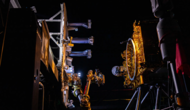
Dr. Ivan Getting, founding President of The Aerospace Corporation, envisioned a more powerful and accurate system, which he saw as “lighthouses in the sky.” In 1963, Aerospace began looking at ways to expand and improve a satellite navigation system. A 1963 Aerospace study, led by Phillip Diamond, recommended a concept called 621-B and with Getting’s energy and foresight, the Air Force formed a new satellite navigation program named 621-B. Further system studies by Aerospace engineers James Woodford and Hideyoshi Nakamura completed in 1966 recommended an architecture where measurements from four satellites would eliminate the need for high-accuracy clocks in the receivers. This served to significantly reduce prohibitive costs, thereby advancing the adoption of the technology by making it more economically feasible.
Based on the architecture, each satellite would be equipped with its own clock, periodically updated via signal from ground stations, which would monitor the positions of the GPS satellites with a high degree of precision and accuracy. Later, the decision to move the clocks from the ground receiver to the satellite would have massive implications: Without the need to include a clock on the ground, GPS devices could be shrunk down –eventually small enough to fit inside a cellphone.
Throughout the rest of the 1960s, the development of GPS was aided by technological advancements such as solid-state microprocessors, computers, and bandwidth utilization techniques. The development of atomic clocks at the Naval Research Laboratory’s (NRL) Naval Center for Space Technology led to advances in a satellite-based navigation system known as Timation (Time Navigation). The first two Timation satellites, launched in 1967 and 1968, were equipped with crystal oscillator clocks. A third satellite, launched in 1974, became the first equipped with an atomic clock, which greatly improved accuracy and provided three-dimensional location coverage.
Forging The Path Forward
In November 1972, Air Force Col. Bradford Parkinson was tasked with overseeing the satellite navigation program. Parkinson led a team in developing a concept that synthesized the best aspects of TRANSIT, Timation, and Project 621-B. This revised system proposal received Defense Department approval in December 1973 for a passive 1-way ranging system of 24 satellites, which used atomic clocks at medium Earth orbits to provide a 12-hour period.
The primary incarnation of this approach began in 1974 when the U.S. Air Force started development of the first of a series of Navstar satellites, the ground control system, and various types of military user equipment.
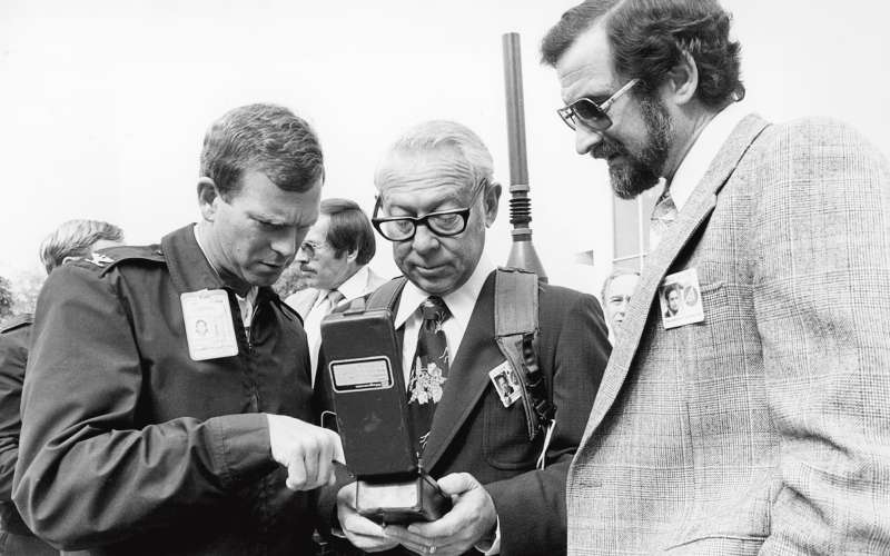
In February 1978, the first Block I developmental Navstar/GPS satellite launched, with three more Navstar satellites launched by the end of 1978. More than 700 tests were conducted between 1977 and 1979, in which Aerospace engineers helped confirm the accuracy of the integrated space/control/user system. Additional GPS Block I demonstration satellites were launched in the early 1980s.
Importance Of GPS In National Security
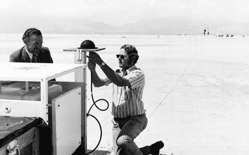
In 1983, President Ronald Reagan authorized the use of Navstar (or GPS as it became known) by civilian commercial airlines in an attempt to improve navigation and safety for air travel. The authorization to provide free access to GPS data to industries outside the U.S. military became the first step towards authorized civilian usage. By 1989, commercially available hand-held GPS units hit the market, including the Magellan Corporation’s Magellan NAV 1000, which weighed 1.5 pounds, offered only a few hours of battery life, and cost $3,000.
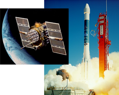
GPS technology continued to improve through the 1980s and 1990s. The production and development phase began in 1985 and the first operational GPS Block II satellite was launched on a Delta II rocket in 1989.
Concern also grew within the government that U.S. adversaries could utilize the GPS system, and its information, against the U.S. In response, the Defense Department decided to adjust the system to be less accurate in non-military applications (known as “selective availability”) in order to deter any usage by enemies.
Proliferation And Wider Adoption of GPS
As GPS coverage continued to expand to full operational capabilities, so did its reach into the lives of civilians. GPS technology appeared for the first time in a cellphone in 1999 when Benefon released Benefon Esc!, a GPS-equipped phone that would lead the way for more. GPS technology also began to show up in automobiles.
In 2000, the government approved plans to add three additional GPS signals for non-military use. More importantly, the US government ended the “selective availability” program that decreased the accuracy achievable by civilian GPS users. As a result of this decision GPS signals instantly became 10 times more accurate for civilians overnight.
The price of GPS receiver and processing chips also dropped from roughly $3000 to $1.50. The increase in accuracy coupled with the decrease in cost led to exponential growth in GPS usage for in-car navigation, location-based services, personal technology and usage in shipping, sailing and other industries.
The New GPS
By 2000, it was recognized that the system needed to be modernized to meet rapidly expanding military and civilian applications. A strategy to add new signals to satellites not yet launched was developed, while meeting the full modernized requirements would take a new program, designated GPS III.
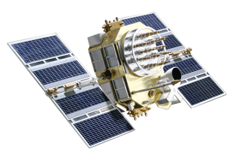
By 2005, the Block II satellites included five different configurations with different capabilities: original II's, IIA's, IIR's were already on orbit; the eight modernized IIR-M's began to be launched, and 12 modernized IIF’s were in full development. The first modernized IIF was launched in 2010, with the remainder launched by 2017.
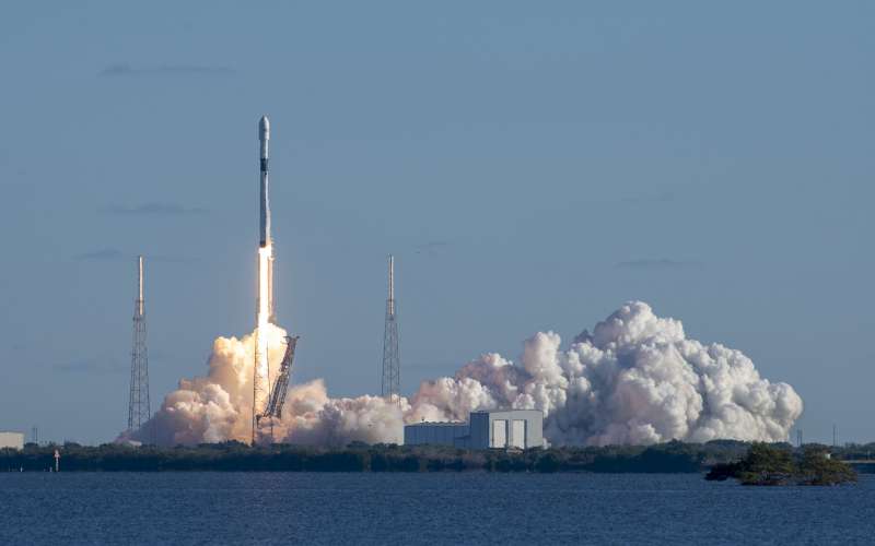
At the same time, the GPS III program began its DoD approval path, leading to satellite contract award in 2008, and ground system contract award in 2010. The first GPS III satellite was launched on a SpaceX Falcon 9 in 2018, followed by the second satellite launched on a ULA Delta IV in 2019 and the third and fourth GPS III satellites launched on Falcon 9 rockets in 2020. The remaining six satellites are scheduled to be launched by 2023.
To complete a full constellation of modernized GPS satellites, the GPS III Follow-on (GPS IIIF) satellites are currently in development.
The impact of space-based navigation technology on our world continues. It’s also not just the direct PNT data, but it’s the integration of that data with other data that makes it so valuable for maps, weather and synchronized/crowd-sourced data. Reports estimate that since the 1980s, GPS satellites have helped generate nearly $1.4 trillion in economic benefits. PNT timing is crucial for running our data networks and financial systems. We use it for the scientific study of earthquakes, volcanos, and the movement of the tectonic plates. Space-based navigation is used to aid construction and optimize farming, including the application of water and pesticides. A 2019 study estimated that between 2007 and 2017, GPS-enabled location-based services such as guidance apps helped American consumers save 52 billion gallons of fuel and drive over one trillion fewer vehicle-miles.
That includes finding you the best route to that new restaurant.
How You Use Space More Than You Realize